Jason Davis • May 15, 2019
Here's a Roundup of Recent OSIRIS-REx Postcards from Bennu
NASA's OSIRIS-REx spacecraft is continuing to chug along at asteroid Bennu. It’s currently sweeping arcs between the asteroid's north and south poles, gathering scientific data that will also be used to select 12 possible sites for sample collection. The OSIRIS-REx team has also been releasing stunning new images from the mission's prior phase.
The current phase of the OSIRIS-REx mission, which began began in April and will continue into June, is called Detailed Survey: Equatorial Stations. The spacecraft is scanning Bennu from top to bottom at different sun angles from a distance of 5 kilometers from the asteroid's center. Emily Lakdawalla summed this phase up well in our OSIRIS-REx at Bennu preview article:
These data will help the team build models for how the surface of Bennu reflects light differently at different angles. This is called photometry. With this data set, the team will be able to correct images for solar illumination, to help them produce seamless photo mosaics. Once they have the photometry data set in hand, they'll be able to make color ratio maps, which should make subtle color variations on the asteroid much easier to see. They'll also make a map of the asteroid's thermal properties. In the long term, these maps will be important for geology research, but in the short term, it will help identify regions of interest and regions that are hazardous for sampling.
At the end of the equatorial survey phase, the team should have 12 candidate sample collection sites. OSIRIS-REx will next move into its Orbital B phase, which is similar to Orbital A but with an even-closer orbital radius of roughly a kilometer. As the team gets closer looks at the candidate sample sites, they'll pick just 1 or 2 finalists, and perform a detailed reconnaissance of the top site from a distance of 225 meters no earlier than September. If that up-close look proves that the site is hazard-free and a good choice for sampling, they’ll proceed, but if the spacecraft discovers the site is unsuitable, it can recon others.
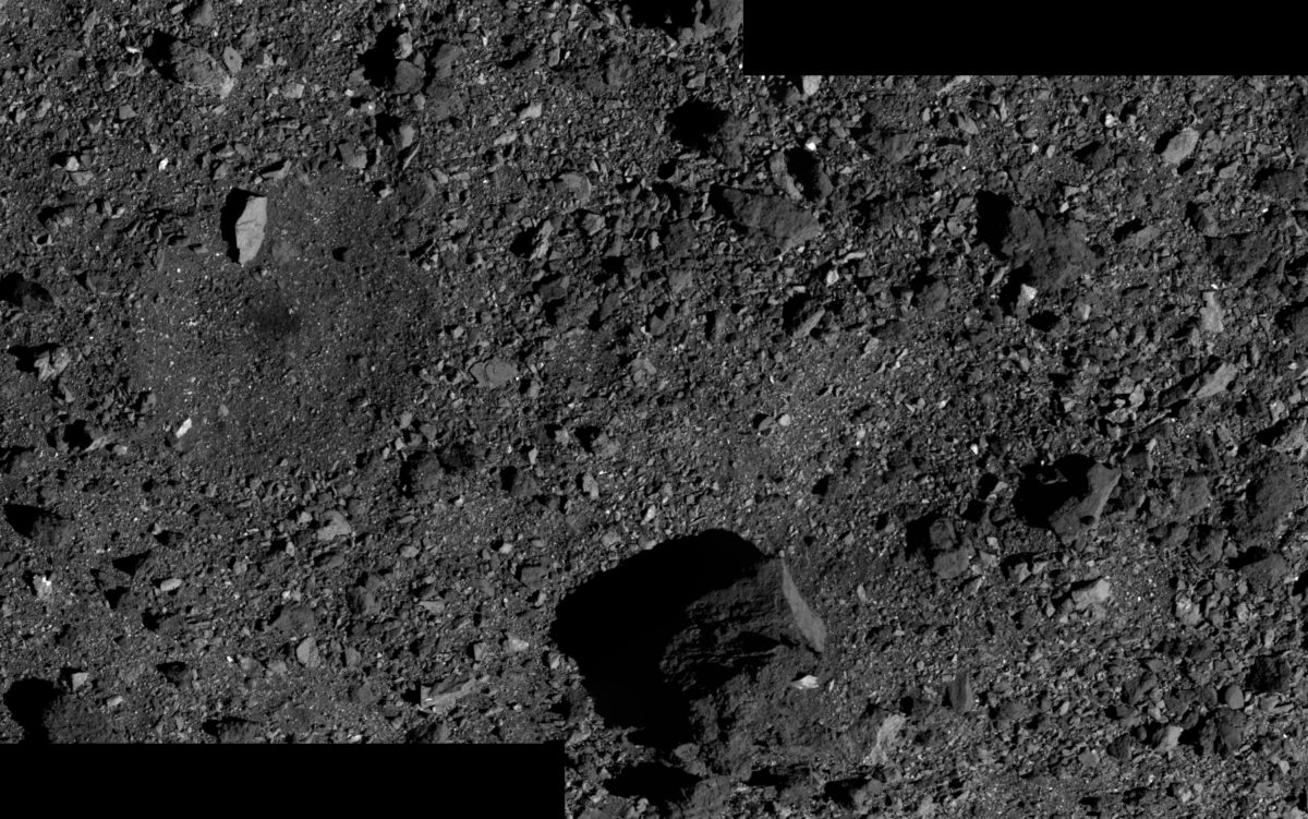
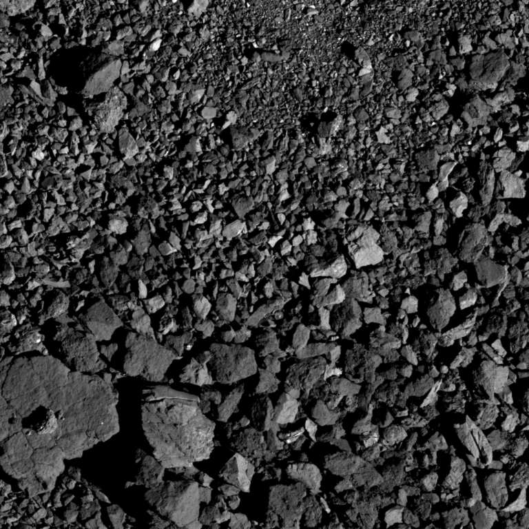
The mission has also been releasing a steady drip of images from its prior Detailed Survey: Baseball Diamond phase. This survey sent OSIRIS-REx flying past Bennu at a variety of different angles, resulting in images from lots of unique perspectives.
Here are a couple overhead shots: A panorama that includes a potential sample collection candidate site, and a picture of some boulders sorted neatly by size.
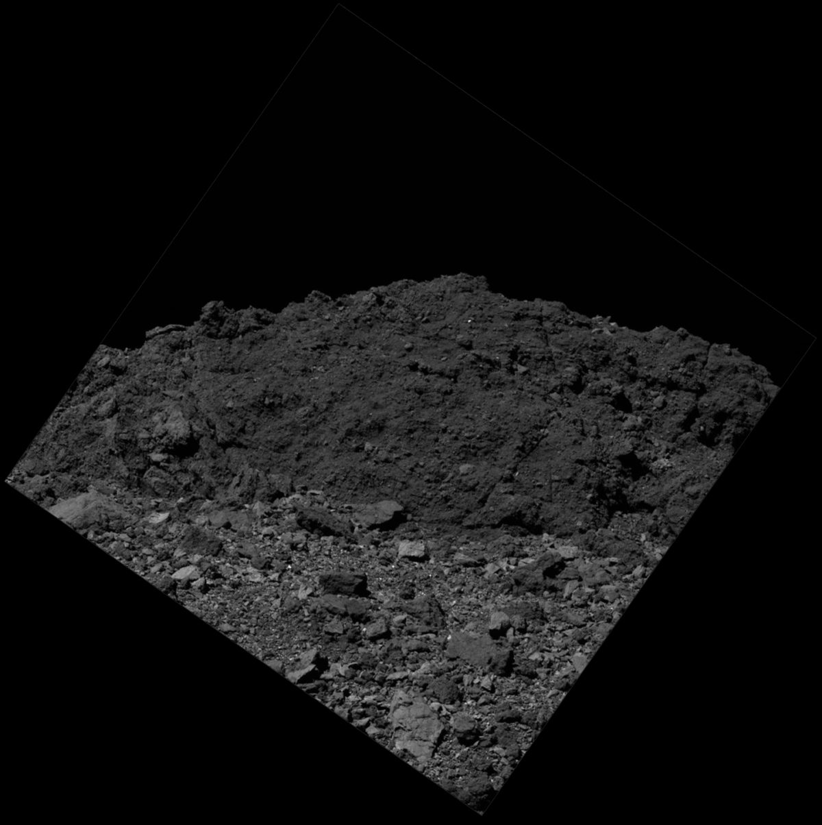
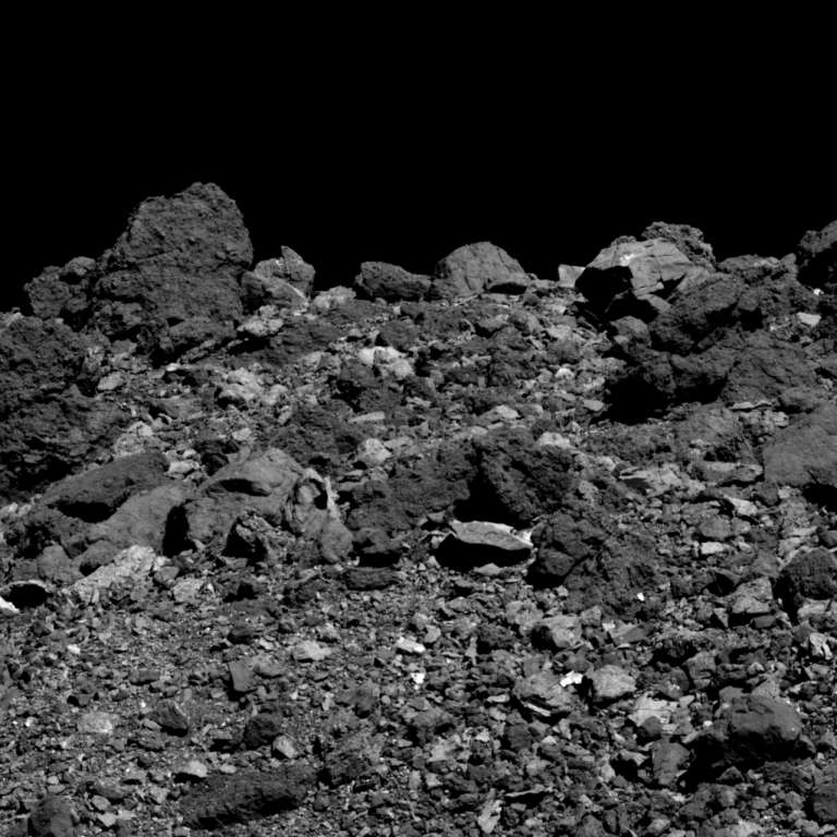
There are also some pretty unique images where the camera is pointing off-nadir, near Bennu's horizon. My preferred way to view most of these is by orienting them with space up, to make me feel like I’m standing on the surface.
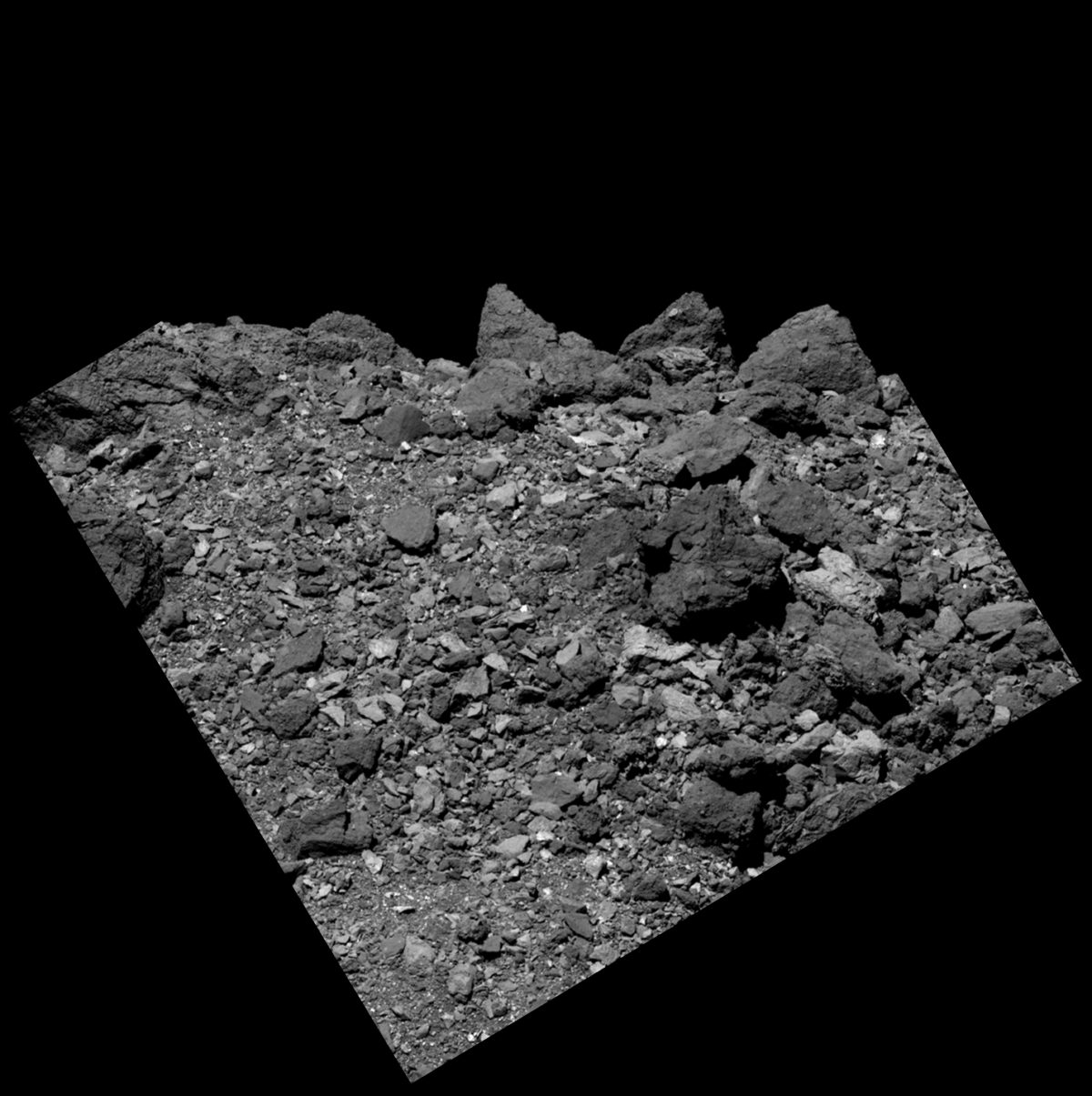
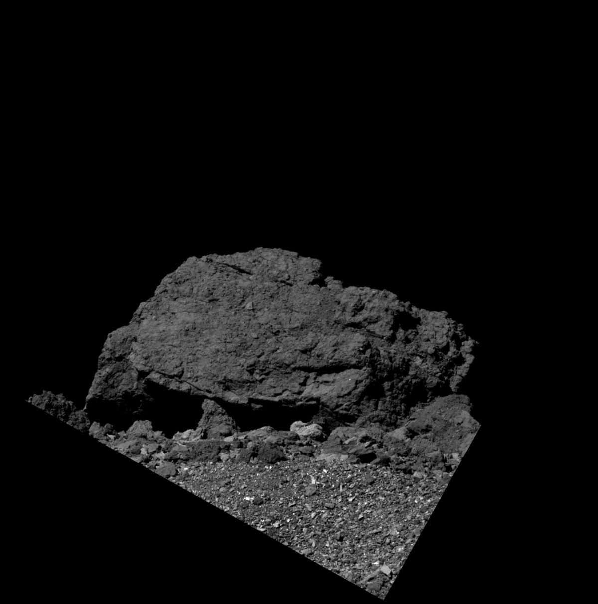
Finally, there’s this great shot of one of Bennu’s easiest-to-identify surface features: Boulder No. 1, also known as “BenBen.” This was the first boulder OSIRIS-REx identified during approach, and at 21.7 meters tall, it also happens to be the largest.
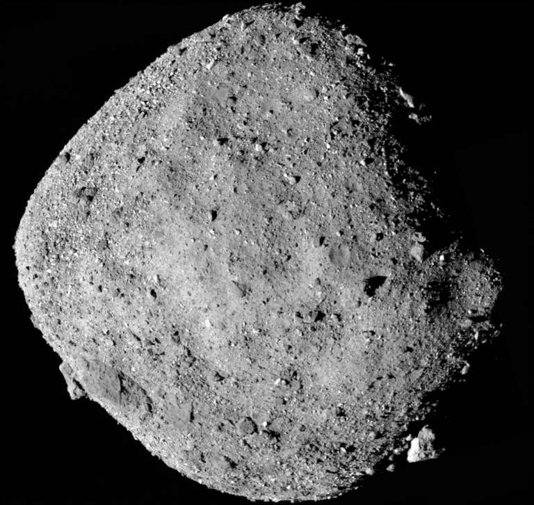
Here’s a wide shot of Bennu from earlier in the mission. You can see Boulder No. 1 sticking out of the asteroid in the lower-right.
Let’s Go Beyond The Horizon
Every success in space exploration is the result of the community of space enthusiasts, like you, who believe it is important. You can help usher in the next great era of space exploration with your gift today.
Donate Today

 Explore Worlds
 Find Life
 Defend Earth